
Story of the Marlyville-Fontainebleau Section
THE LOCATION
Early New Orleans, with its notoriously inhospitable climate and scarce habitable high ground, was a compact, poorly-drained, under-developed city. As the population grew beyond the French Quarter, locals confronted the challenges of devastating seasonal floods and worsening sanitation that brought widespread, life-threatening outbreaks of disease. By the late 1800s, a promising remedy for these chronic woes lay on the horizon… a modern, new drainage system.
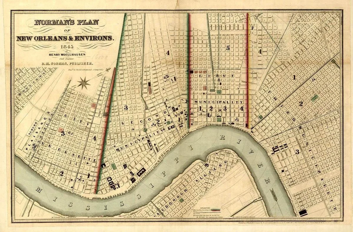
Plan of New Orleans and Environs (1845)
Despite having been ranked as America's third-largest city in 1840, New Orleans’ population growth thereafter remained lackluster, while more vibrant urban and industrial cities like Philadelphia, Boston and Cincinnati forged ahead.
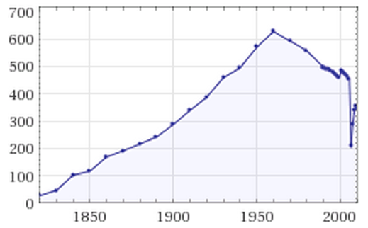
New Orleans population 1820-2010 (in thousands of people)
The Southeast Louisiana region’s failure to diversify commercially in response to the Reconstruction Era dismantling of the plantation system contributed to a period of fiscal stagnation. With so few natural resources available to compensate, the local New Orleans economy, for a century reliant on the sugar and cotton industries – the Tchoupitoulas district alone comprised 26 cotton presses in 1873 – became ever more dependent on textiles, tourism, entertainment, shipbuilding and river trade.
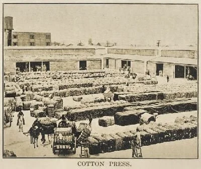
Interior view of a cotton press along Tchoupitoulas
By contrast, the early 1900s brought surprisingly rapid development to New Orleans, owing in no small part to the advent of electric lighting, a modern sewer system, improved water purification and drainage technology (founding of Sewerage & Water Board, invention of Wood screw pumps), massive earthworks (landfill, reclamation from Lake Pontchartrain), new road-building methods (concrete and asphalt paving replaced wood, brick and stone) and the proliferation of mass transportation (ferries, buses, New Orleans & Carrollton Railroad and streetcars).
Residential neighborhoods could finally expand beyond the limits of high ground earlier afforded by natural levees and ridges. In this way, former cotton, sugar, indigo and tobacco plantations were ultimately transformed into desirable subdivisions, extending the cityscape inward, into vast low-lying areas where swamps, marshland and cypress woods had long held sway.
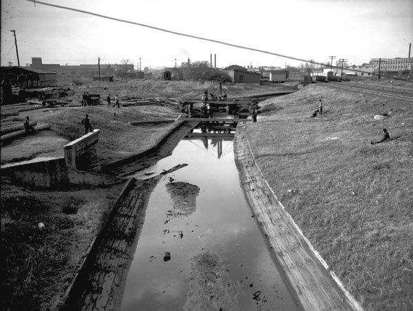
Hagan Canal (left) extended south from Carondelet Canal, near Bayou St. John (1938)
Within a few decades, shallowing vestigial Mississippi River distributaries, having sculpted the local geography (Metairie Bayou and Bayou Gentilly) for centuries, were completely filled in. Any remaining Spanish- and French-era drainage ditches (Carrollton Spur, Hagan Avenue Canal) were enclosed. Former service canals – dug by immigrant laborers prior to the age of steam power – were now unceremoniously abandoned, to be overlaid with roads (New Basin Canal became West End Boulevard). Others still were repurposed as covered drainage conduits (Carondelet Canal and Turning Basin), alleviating fears that they might again channel hurricane flood waters into the city proper.
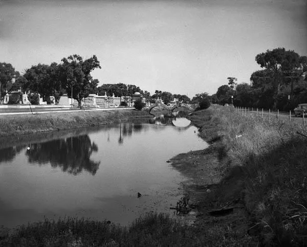
Old Metairie Bayou once flowed past Metairie Cemetery toward City Park (1953)
Thus ended an era when mule-drawn flatboats and steamship commerce reached the city center via the placid, sea-level waters of Lake Pontchartrain. The elimination of stagnant waters may have helped ward off mosquito-borne diseases such as yellow fever, improving the quality of life for everyone. But the citizens of New Orleans, rejoicing for this respite from floods, so grateful for the convenience and predictability of terra firma, overlooked the negative long-term impact on soil subsidence. Portions of the city now sink at a rate of up to 1.5 inches per year!
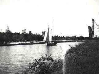
The New Basin Navigation Canal ran from Loyola Avenue to the Lake (1895)
Following the devastation caused by Sauve’s Crevasse in 1849 and the Great Mississippi Flood of 1927, progressive strengthening of the city’s flood protection system (Bonnet-Carré Spillway, levees, storm walls) warded off inundations that had rendered roads impassable. It also lowered the risks from seasonal river flooding and levee failure, arguably the most potent threat to life, livelihoods, property, indeed the very existence of New Orleans.
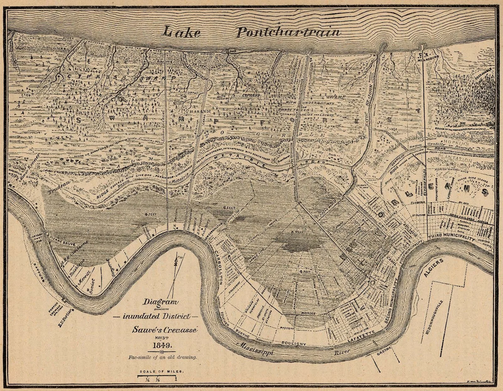
A levee breach at Sauve’s Crevasse (lower left) flooded much of New Orleans (1849)
Concerted efforts to eliminate a multitude of railroad grade crossings and to convert several major outfall canals (Orleans, Broad, Claiborne) into underground box culverts, begun in the 1930s WPA era, allowed the improvement and widening of major east-west thoroughfares (Earhart, Broad, Claiborne, Gentilly), encouraging outward development and interchange with nearby communities. Parallel moves by city planners to formalize residential zoning laws throughout the 1920s resulted in more uniform land use and building practices across town.
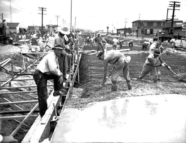
WPA workers converting Broad Street Outfall Canal to a box culvert (1939)
View of Broad Street, after covering and paving, west from Howard Avenue (1940)
THE PEOPLE
Although the population of New Orleans rose to a historic peak by 1960, an abrupt outflux toward the suburbs ensued upon the completion of the Interstate Highway System, the opening of the first Mississippi River Bridge in 1958, and the ready availability of land in neighboring parishes. Monied families were enticed to take up residence away from the aging city center, effectively eroding the city's tax base. The less mobile working-class remained, often taking up residence just around the corner from their more affluent employers, while public housing offered low rents along with a short walk to work. In the newly desegregated Orleans Parish of the 1960s, one could easily sample every stratum of society within just a few blocks.
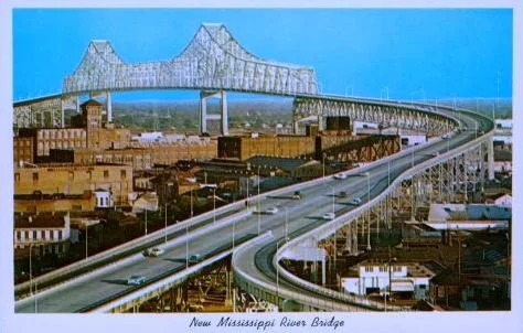
Pontchartrain Expressway connects Orleans to surrounding parishes
Marlyville-Fontainebleau neighborhood perfectly illustrates this layered framework. For example, the four blocks of Grape Street connect the elegantly broad, canopied Vendome Place with a comparatively modest, narrow, treeless Panama Court, to which curbs and drains were not added until 2024. Midway one finds the staunchly middle-class Vincennes Place followed by a well-mixed State Street Drive with its abundance of post-war rental properties. Further west lies College Court, where so many descendants of skilled laborers reside in tightly-spaced, humble shotgun houses.
THE SUBDIVISIONS
Astride the better-known neighborhoods of Gert Town, Broadmoor, Carrollton and Uptown, Marlyville-Fontainebleau represents an amalgum of several historic subdivisions situated to the rear of Uptown New Orleans. These slender, wedge-shaped tracts were known locally as the “Faubourgs,” of Hurstville, Bloomingdale, Burtheville, Marlyville and Friburg, names memorialized in countless property deeds today. Their converging “upperline” (upriver) and “lowerline” (downriver) boundaries demarc former plantations that radiated away from a curving Mississippi River, for whose meanders New Orleans came to be called “Crescent City”.
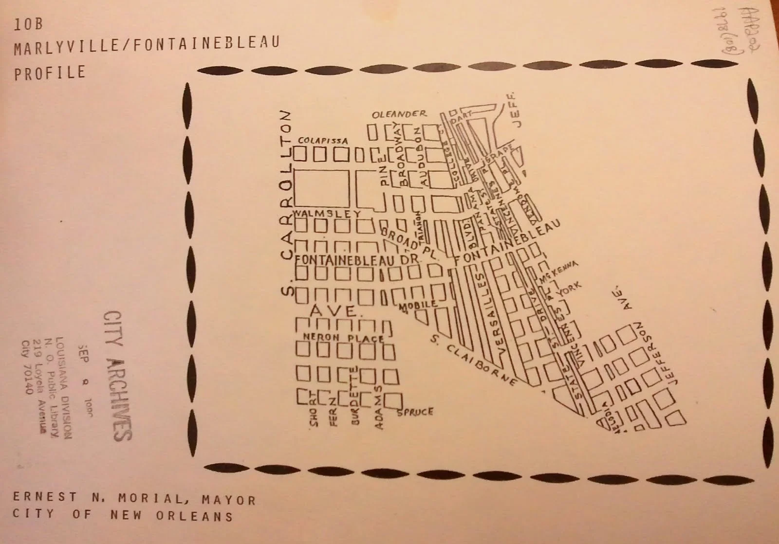
Diagram of Marlyville/Fontainebleau Neighborhood in City Archives (1978)
With State Street as its backbone, Bloomingdale subdivision was laid out in 1836 on land purchased by developer John Green two years earlier. Realizing that New Orleans’ westward expansion portended the absorption of several intervening municipalities (the cities of Lafayette, Jefferson and Carrollton), clothier and noted speculator Bernard Fellman acquired sizable portions of still-rural Bloomingdale and Rickerville in the 1870s, expanding the portfolio of his family’s holding company, Bernard Co.
This $10,000 collection of parcels came to be known as “The Fellman Tract” which stretched downriver beyond Jefferson (then Peters) Avenue. Considered wasteland prior to being drained, its open fields were home to grazing cows, who sometimes shared their pasture with visiting circuses, baseball diamonds, even a makeshift airfield.
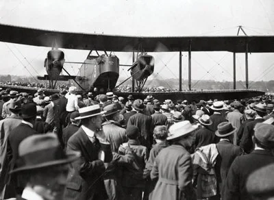
The bomber Andalusia visiting to promote Liberty Loans (1919)
Upon Bernard Fellman's death in 1892, the property passed to his 14-year old son, Leo, who would eventually leave New York to take the helm at Bernard Co.’s headquarters. The company’s roster over the years has included Bernard’s brother Leon, co-founder of Krauss Co.; Leo's late wife, Alice; their children John Henry and Mary Anna; as well as a few descendants who still own and manage property throughout the area over a century later.
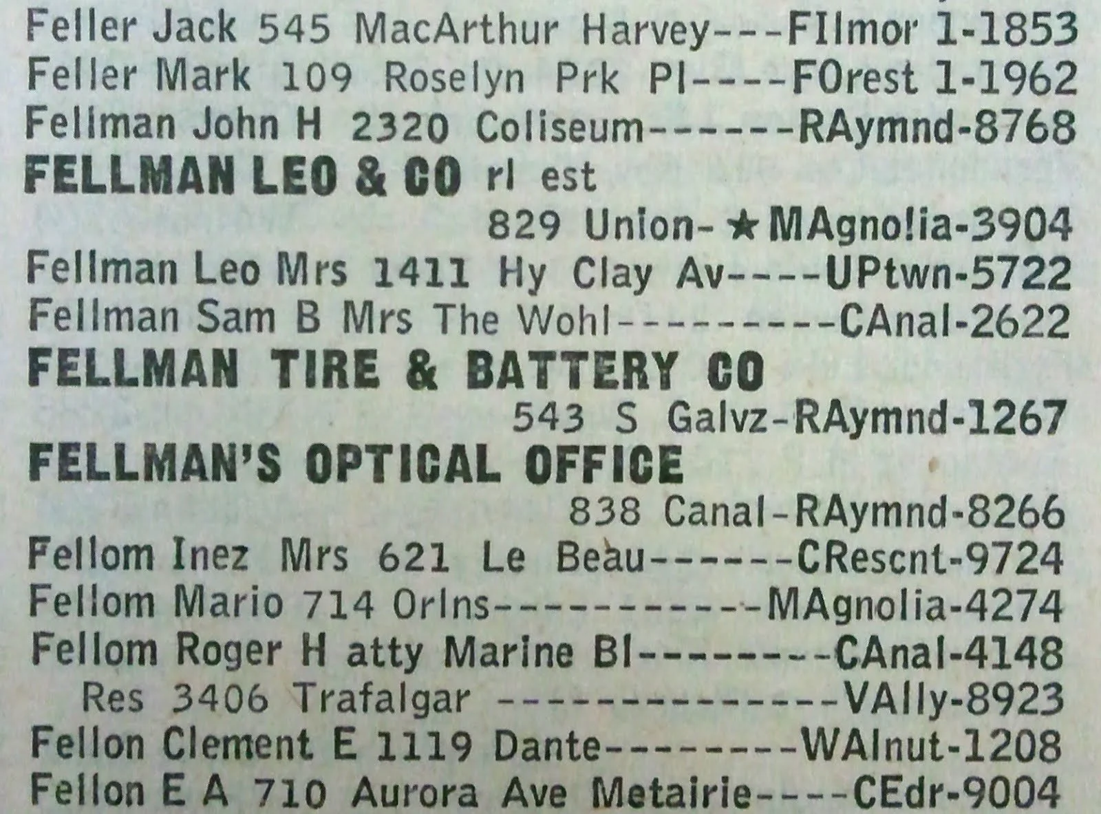
Leo Fellman’s listings in the City Directory (1950)
Notwithstanding the successful annexation of mile-long State Street Drive in 1914 and a flurry of home-building activity along Jefferson Avenue and Octavia Street in the early 1920s, broader development of Marlyville-Fontainebleau almost immediately slowed due to the Great Depression's stymying effect on investment. Indeed, by the time of Leo Fellman's passing in 1934, significant portions of Bloomingdale and adjacent Broadmoor remained undeveloped and his vision for these subdivisions unfulfilled.
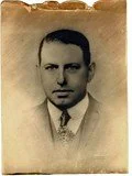
Leo Fellman (1878-1934)
Nevertheless, the Fellmans’ stewardship of these fledgling residential parks eventually paid dividends; improved drainage, wider and better-aligned streets, modern pavement, safer sidewalks, and pockets of commerce. For families hoping to find affordable housing near the center of town during the economically booming and progressive age following World War II, the neighborhood of Marlyville-Fontainebleau represented an appealing destination.
THE STREETS
Disjointed planning and capricious landholders' naming schemes were dogged hallmarks of the early municipal roadway system. New Orleans’ steady – sometimes forcible – absorption of existing upriver communities throughout the nineteenth century led to confusion as new sections were incorporated into the city map. Bends in the river only compounded the problem by causing streets to approach at odd angles. Surveyors did their best to rectify the wayward grid.
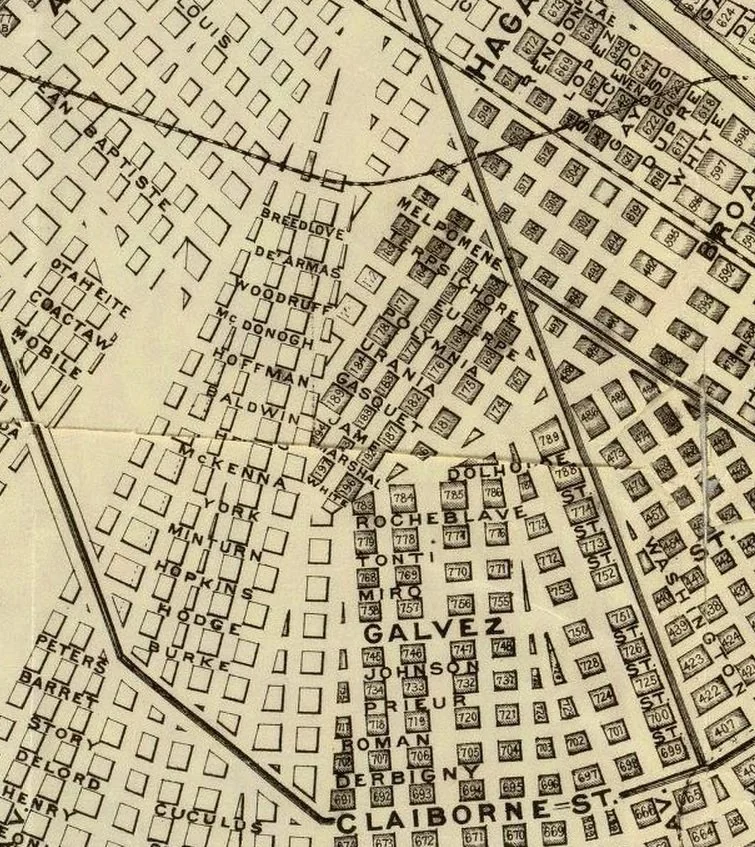
Disjointed street layout above Claiborne; State St. intersects lower-left corner (1885)
For instance, following its annexation in 1874, the City of Carrollton contemplated renaming First Street as St. Charles Avenue, given the latter’s crossing of another First Street down in Faubourg Livaudais. On July 9, 1894, New Orleans city commissioners accomplished this with the passage of voluminous Act 9411, decreeing all of Carrollton’s numbered streets be renamed after hardwoods or fruit trees (Maple, Birch, Apricot through Quince, etc.).
Walmsley Avenue (formerly Apricot Street) before repaving project (circa 1950)
Unsurprisingly, given the strength of tradition (not to mention rampant illiteracy and plain laziness) among New Orleanians, locals often clung defiantly to the original street designations, thus perpetuating the memory of bygone benefactors, war heroes, civic leaders, heads of industry and colorful politicians. Carrollton’s Seventeenth Street – site of the eponymous outfall canal – remains in the vernacular to this day. Closer by, sections of modern-day Vincennes Place were known variously as Baldwin Court or Richardson (sometimes Richard) Court over a span of only eight years (1915-1923), before finally memorializing the Parisian château. (See “List of Streets”, below)
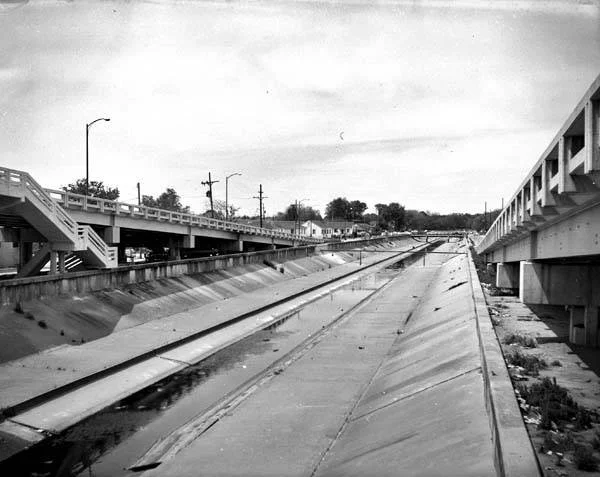
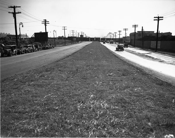
View of Seventeenth Street Outfall Canal, north from Airline Highway (1956)
From the end of World War I through the 1940s, City planners continued their quest for much-needed consistency, under a new set of forward-thinking principles: Streets would be given a unique designation over their entire length; numbering of houses should be uniform; naming streets in honor of contemporary public figures took precedence over those from past eras; sidewalks must be graded and paved; and, wherever possible, roadways would be made to align and conform to modern standards of construction and drainage.
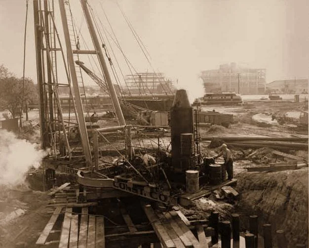
Construction of Jefferson Davis overpass, with view of railroad tracks (1951)
Conveniently for developers like the Fellmans, the City in 1916 passed Act 83, permitting the exchange of property with private landowners pursuant to the widening or realignment of existing streets. Working alongside the City Council of 1923, surveyors thus began opening new streets and closing old ones, trading land for rights-of-way, valiantly attempting to establish an orderly network of roads in nascent Marlyville-Fontainebleau.
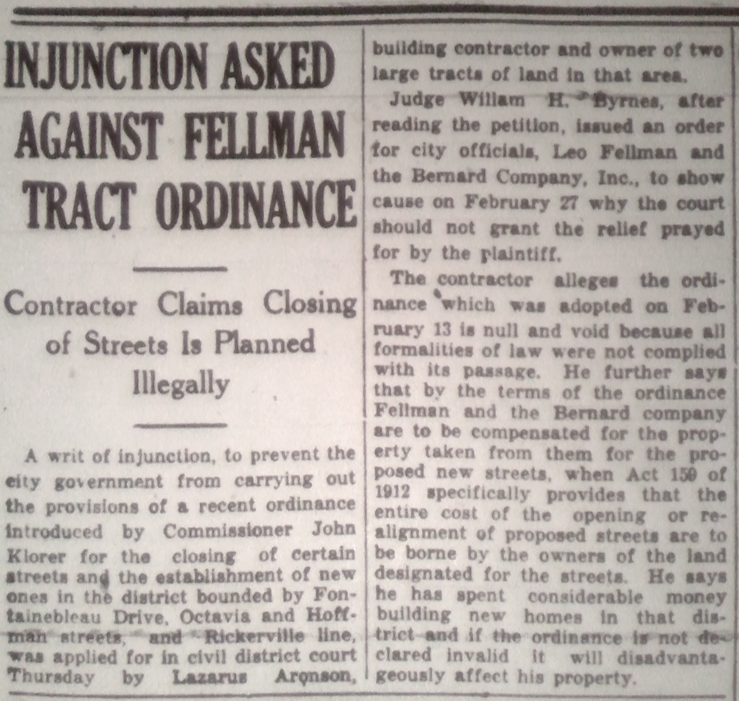
Contractor Lazarus Aronson contested the closing of Joseph Street (1929)
Some of the proposed street changes were quite controversial. For example, serious consideration was briefly given to creating a multi-lane extension of Jefferson Davis Parkway from Mid-City to Uptown, which the public rejected. One contractor, who owned property adjacent to the Fellman Tract, unsuccessfully petitioned the court to prevent the 1929 closure of Joseph Street between Rocheblave Street and Fontainebleau Drive.
Other changes appear to have backfired, orphaning segments of former through-streets: Broad Place, Breedlove, York and General Pershing, among others. Similarly, the reversed numbering along Jefferson Davis, “missing” blocks of Fontainebleau, and out-of-order addresses on Calhoun and State (since rectified) serve as a reminder how difficult it must have been to reconcile this new grid with the old one.
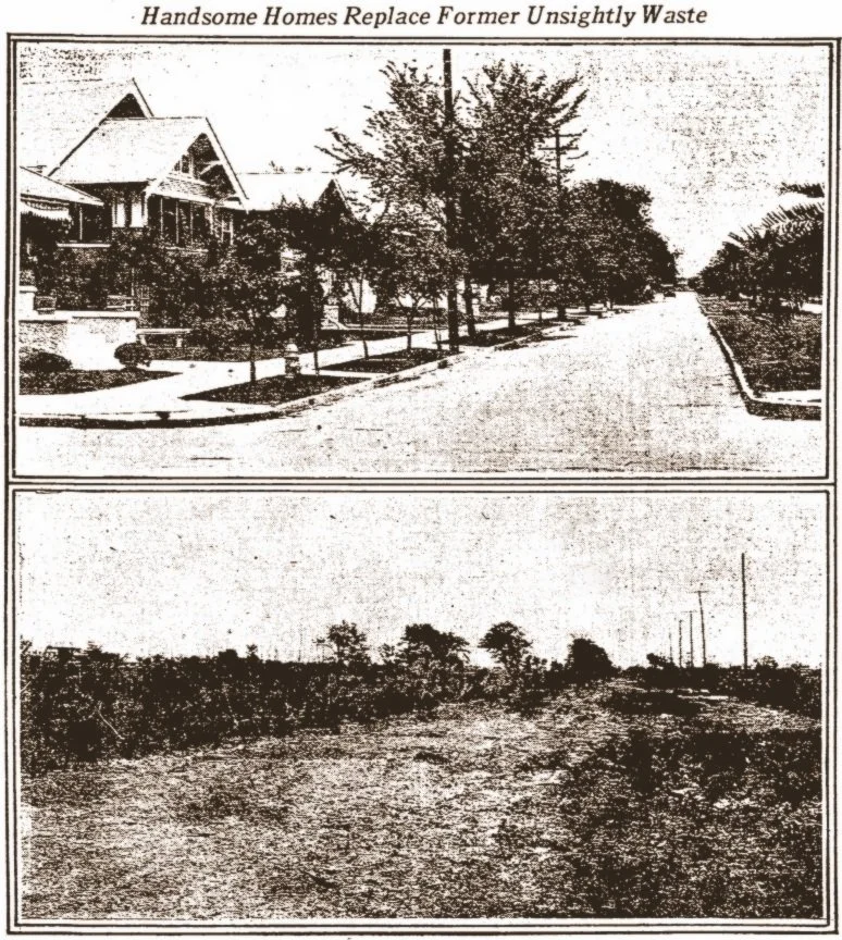
Jefferson (Peters) Ave. & Clara St. before (1915, bottom) and after (1923) development
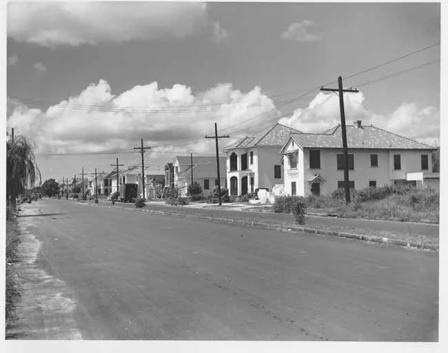
Nashville Avenue, from Fontainebleau toward Hewes, as it appeared in the 1940s
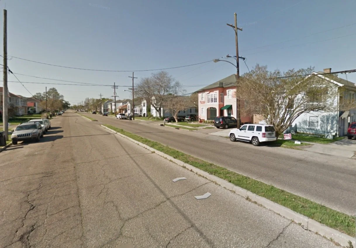
Nashville Avenue, from Fontainebleau toward Hewes, as it appears in the 2010s
STREETS OF MARLYVILLE-FONTAINEBLEAU
| STREET | HONORS | ORIGINALLY | RENAMED | NOTES |
|---|---|---|---|---|
| Breedlove St. | James Breedlove, local banker | (unchanged) | 1926 | Now landlocked |
| Calhoun St. | John Caldwell Calhoun, U.S. Senator | Edmond St. | 1894 | Address 3220 is out of numerical order |
| College Ct. | Nearby schools | (unchanged) | – | |
| Dart St. | Capt. Pierre D’Artaguette | Gordon St., D’Artaguette St. | 1911, 1942 | Killed while attacking Chickasaw villages |
| Earhart Blvd. | Mayor Fred A. Earhart | 14th St. | 1949 | Part of 14th became Oleander St. |
| Fontainebleau Dr. | 1762 Treaty of Fontainebleau | 11th St., James St., Baldwin St. | 1912, 1924 | Excluded from 1893 House Numbering Ordinance |
| Galvez St. | Bernardo de Gálvez | Hodge St. | 1924 | |
| General Pershing St. | Gen. John Joseph Pershing | Vincent St., Berlin St., Hoffman St. | 1916 (Part), 1918 (Part), 1924 (Part) | |
| Grape St. | The fruit | De’Armas St. | 1894 | Contains no house addresses |
| Hewes St. | (unknown) | (unchanged) | – | Possibly named for Joseph Hewes |
| Johnson St. | Governor Henry Johnson | Burke St. | 1924 | |
| Miro St. | Governor Esteban Rodriguez Miró | Sauvolle St. | 1924 | |
| Nashville Av. | Nashville Railroad | Beauregard Av. | 1894 | Tracks and stations never constructed |
| Panama Ct. | 1920 Panama Canal opening | (unchanged) | – | |
| Pritchard Pl. | R.O. Pritchard, hotelier | Brickyard St., Woodruff St. | 1913, after 1938 | Extension of Pritchard Street |
| Rocheblave St. | Philippe-François de Rastel de Rocheblave | Minturn St. | 1924 | |
| State Street | State of Louisiana | (unchanged) | 1895, 1939 | State Street Drive annexed in 1914 |
| Tonti St. | Henri de Tonti | Hopkins St. | 1924 | |
| Vendome Pl. | French province | (unchanged) | 1939 | |
| Versailles Blvd. | French province | (unchanged) | – | |
| Vincennes Pl. | François Marie Bissot de Vincennes | Baldwin Ct., Richardson Ct., Richard Ct. | 1924, 1927 | |
| Walmsley Av. | Mayor T. Semmes Walmsley | 12th St., Apricot St. | 1894, 1949 | Curb tiles still read “Apricot” at several corners |
SUGGESTED READING
“Database of City Streets” at data.nola.gov
“Rising Tide” by John M. Barry
“New Orleans Past” Collection of Memorabilia
“History of New Orleans” by John Smith Kendall
“WPA Photographs Collection” at New Orleans Public Library
“Photographs Arranged by Street Name” at New Orleans Public Library
“Synopsis of City Ordinances: 1841-1937” at New Orleans Public Library
“Frenchmen, Desire, Good Children” by John Churchill Chase
“Streets of New Orleans” by Peter Hickman
“New Orleans History: Lake Pontchartrain” on Pontchartrain.net
“History of New Orleans Drainage” by U.S. Army Corps of Engineers
“Gutter to Gulf: Legible Water Infrastructure for New Orleans” at University of Ontario
“Alexander Allison Photograph Collection” at New Orleans Public Library
“Time and Place in New Orleans: Past Geographies in the Present Day” By Richard Campanella
“Louisiana Almanac 2008-2009” by Milburn Calhoun and Bernie McGovern
“The Picayune’s Guide to New Orleans” at Storyville District New Orleans
“Water Planning for Southeast Louisiana” at Living With Water
“New Orleans Flood Protection Systems” by Independent Levee Investigation Team
“NolaWiki” at UptownMessenger.com